Trip Stats!
Round trip time and distance: Approximately 5-7 hours and 13 kms
Elevation Gain and Max Elevation: 1,196 m; 3,054 m
If you live in the Calgary or the surrounding area, it’s likely that you’ve hiked or snowshoed to the incredibly popular Chester Lake in Spray Valley Provincial Park in Kananaskis Country. It’s an incredibly popular trail for good reason too – it is relaxing stroll 4.6 km (one-way) and only 300m elevation gain along a well-maintained trail (maintained both in the summer and winter), to reach a small but pristine lake in a sprawling alpine meadow. Chester Lake is a wonderful lake to visit in every season; one can spend a relaxing afternoon fishing for trout or dolly varden in the summer, admiring golden larches in the autumn, or admire snow-covered peaks while cross-country skiing or snowshoeing in the winter.

I’ve been to Chester Lake on several different occasions in different seasons, but this time the goal was to scramble up Mount Chester which towers behind the lake at an impressive 3,054 meters. I went out for the day on August 3rd with two of my colleagues who also love the mountains but more importantly, don’t shy away from long and strenuous days in the mountains either. The three of us even endeavored to complete the entire Northover Ridge Trail in a single day – and succeeded (for context, this is a backpacking trip that people usually take 2 or 3 days to complete)! One of my colleague’s friends also decided to tag along for the trip, and I brought along Heidi, my adventure dog! Mount Chester would be her most “difficult” mountain to date, she has had longer days on the trail but not with the level of scrambling, loose rock, and steepness involved with Mount Chester.

We drove to the Chester Lake trailhead parking lot along the Smith Dorian Trail and started hiking up the well-marked trail which follows a logging road for the first two kilometers. After zig-zagging through the trees and few small clearings (which were filled with beautiful alpine wildflowers!) we reached the expansive meadow that provides clear views of Mount Chester with its unique diagonal folds. Shortly before reaching the lakeshore, there is a path that veers to the right and crosses a creek over a small wooden bridge, which lead us straight to the base of the gully that leads up to the saddle. Although many groups opt to go straight up the middle of the gully, Neil, who had done this scramble before, suggested staying on the grassy left-hand slopes above the gully because the scrambling is more interesting and generally it seemed like it would be less of a slog up the black scree.
We ascended a combination of grassy slopes and rocky ledges that angled up and left of the saddle, and this proved to be relatively straightforward, although Heidi got a little nervous trying to navigate a couple steeper ledges. Little did she know; more treacherous ledges and rocky slabs would be up ahead (which she managed to scramble up with more ease and grace than all us human scramblers despite her earlier hesitations).

We came out on the large summit face about a quarter of the way up between the saddle and the summit. From here, there were various faint trails and cairns dotting their way up the mountain, but we mostly picked our own path up alternating between rocky ribs, relatively low-angled slab (don’t trust the photos it is much easier than it looks), and little meandering scree paths. The summit face is like a choose your own adventure for scramblers and provides lot of options depending on your comfort level!

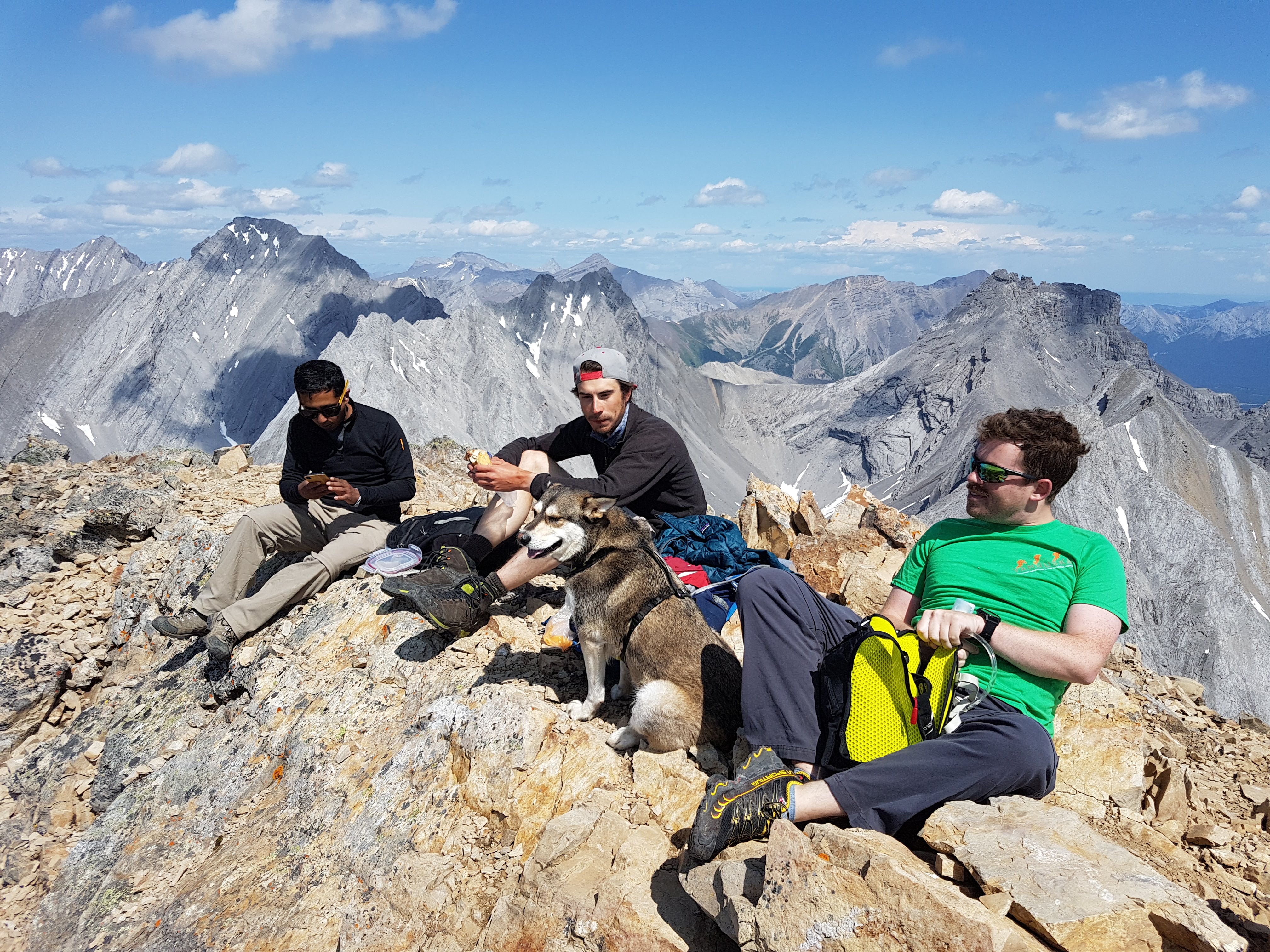
We came to the right-most side of the ridge (it drops off in a near vertical cliff, so don’t venture too far right!!) near the top and followed the easy ridge to the summit. We had virtually no wind, and sunny skies at the top, and had amazing views in every direction! We could see Spray Lakes to the North, Mount Assiniboine to the West, and the Headwall Lakes to the East, amongst dozens of other peaks that I struggled to identify.

After a relaxing lunch and lounge (and photos of course), we picked our way back down the way we came. Although on our descent, we aimed straight towards the saddle, and then took the gully back to Chester Lake (because going down scree is always easier than going up it!).
Manny had left a beer and Mike’s Hard Lemonade in a cooler in the back of his vehicle, so we all passed the refreshing drinks around to celebrate another stellar day out in the mountains!

The photos make the scramble up seem incredibly steep! Great views!
LikeLike
Thanks for reading and commenting! The pictures are deceiving haha – but some sections certainly are quite steep!
LikeLike