The final installment of Victoria and Christina’s grand friend-venture is finally here. I’ll admit this is long overdue, but better late than never right?! If you missed parts one and two, you can find them HERE and HERE!
For the last part of our trip, the plan was to attempt Mount Cline, which is the highest mountain in David Thompson County at 11,027 feet tall. Victoria and I have only climbed one 11,000+ ft mountain in the Canadian Rockies together before – Mount Temple, which (under the right conditions) is a scramble that does not require technical mountaineering as is done as a day trip.
I must caveat that this is not a trip report on Mount Cline! We did not get the chance to summit this classic climb (this time) due to snowier than expected conditions. A cooler than normal summer meant that snow was lingering for much longer at higher elevations, and during our approach to the bivvy site we met two parties that got turned around at two 5.4 rated notches to due snow. We decided to play it safe and turn our mountaineering attempt into a more relaxed backcountry camping trip at Cline Lakes. Instead of Mount Cline, we discovered a fun and easy scramble up the adjacent Mount Owen.
As a side note, I’m not 100% sure the name of this adjacent peak is actually Mount Owen – it is referenced anecdotally as Mount Owen in several blogs and trip reports I’ve found online but I think technically it is a provisional peak so may not have an official name.

Approach to Cline Lakes (Our Bivvy Site)
We packed up our vehicle at Bow Lake, had a quick lunch, and then north on the Icefields parkway and then took the exit onto David Thompson Highway at Saskatchewan Crossing. From here it was a quick 10-minute drive to get to the trailhead. We parked Victoria’s Jeep in the ditch beside Thompson’s Creek, opposite a campground by the same name. There is an obvious (but unmarked) trail right of the creek, which we followed through a lovely forest and mostly follows the creek. The trip report on theoutbound.com is what we followed and was fairly useful in following the unmarked trail, so I’ll just quote it here:
We stayed east side of Thompson Creek for about 1km from the highway then we crossed 2 log bridges. There was an ok trail for next 3.2 km on south/west side of the creek until a gully near a big wall with small waterfalls.
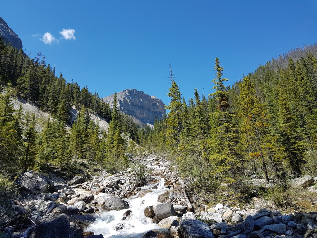
Now here is where we got very lost, we were blindly following some flagging tape that seemed to agree with the route description but completely missed the correct gully to ascend and ended up way deeper in the valley than we should have been. We got as far as the base of a beautiful waterfall that was cascading out of an impenetrable cliff face. We knew we had to somehow get above the headwall above the waterfalls but there was no way to do so from this point. We ended up having to retrace our steps all the way back to the creek until we found the correct gully to ascend. Fortunately, this gully is where we ran into another party descending the route and we had a chat with them about the conditions at Cline. This was the second party we came across that told us they were unsuccessful in their ascent, due to too much snow in the notches.
Well, we had already come this far, and even though we decided an attempt to summit Cline probably wasn’t in the cards for us, we figured we may as well still spend the night at what is allegedly one of the most beautiful bivvy sites in the rockies!
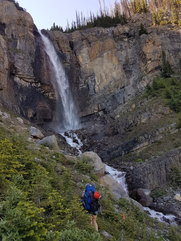
Once we ascended the gully, we followed a narrow trail that traverses a side slope beneath the headwall for what feels like miles. The trail took us onto a steep scree slope and it was almost impossible to keep track of the actual path. We picked our way through boulder fields past two waterfalls (which look to be waterfalls that fed into the earlier waterfall we encountered early on in our trek).

We stayed climbers left of the falls, then hiked through more alpine terrain, climbed up yet another headwall (this one was covered in snow), passed a family of mountain goats and many adorable mountain goat babies (a highlight of the trip so far!), and eventually, finally, after what felt like a lifetime trying to keep track of the near-invisible trail, to the first tarn that is Cline lakes. FINALLY!
Camping at Cline Lakes
There were numerous little rock walls to shelter tents from the wind built around Cline lakes and we had our pick of the entire area! We set up camp and make dinner, cheesy sidekicks pasta with canned tuna mixed in, while watching the sunset. We thought it was the most delicious backpacking meal ever! In reality, it was pretty awful (we know because we recreated it back home after the trip), but a long day of bushwhacking made it taste like a truly gourmet Italian meal!

Victoria taking a quick rest after a looong approach 
Best tent views ever! 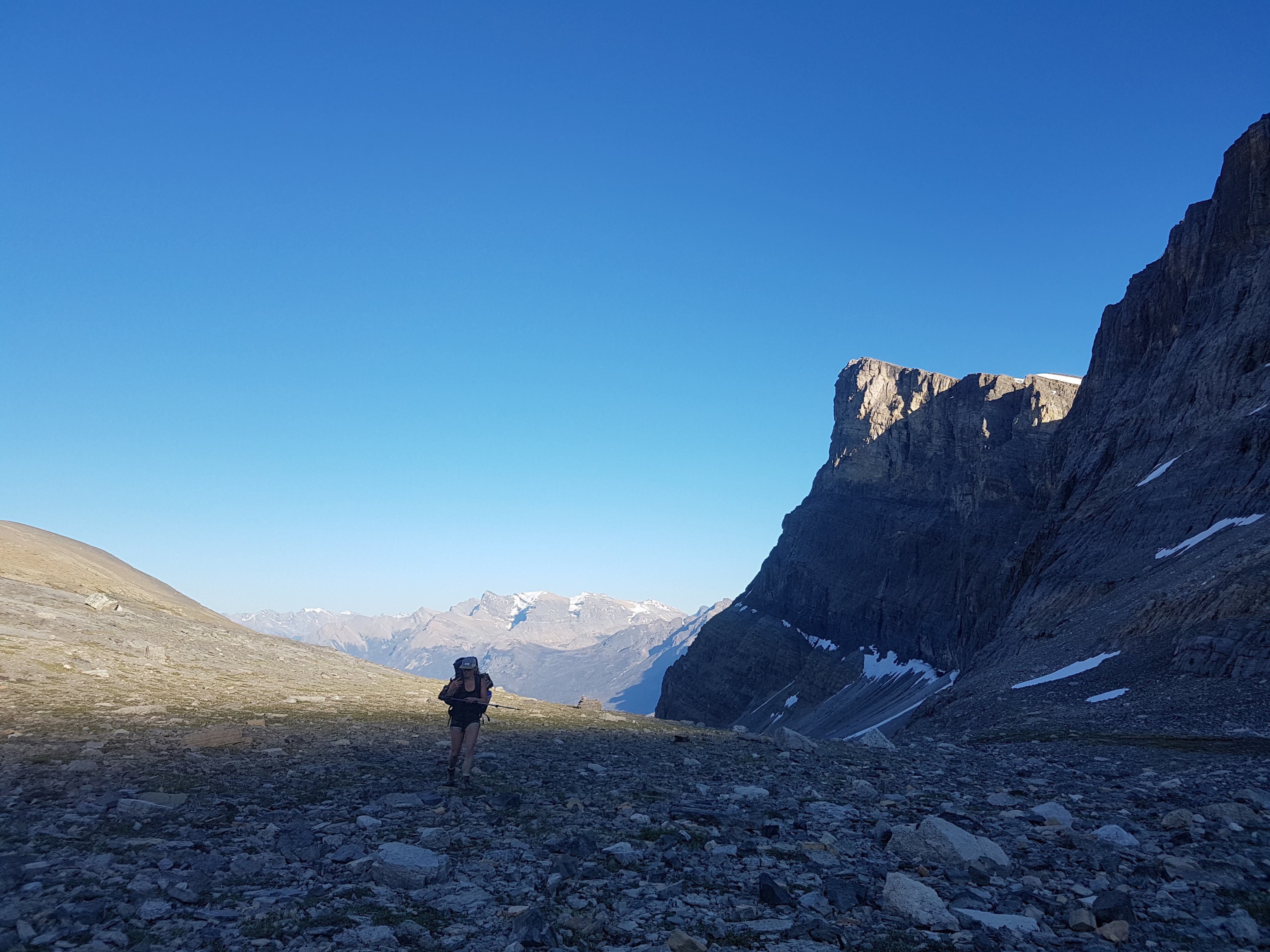
Finally arriving to our campsite at dusk
Mount Owen
The next morning, since we didn’t plan on summiting Cline, we slept in and took our time making breakfast (muesli) and enjoyed a coffee. We then decided to scout out the route to Mount Cline (for future reference!) and explore the area a bit. At the very back of the two lakes there is a large headwall, which we easily scrambled up. At the top of this headwall we were treated with a stunning birds eye view of the lakes. Above the headwall, there was a long slope spotted with snow patches and trickling streams that lead to a glaciated col between two subpeaks of Cline. It was at this point that we opted to stay right and ascend the peak to the right of the col. It was a steady grind up loose scree to ascend this subpeak (which I believe is Mount Owen). When we reached the summit, we were treated to a gorgeous view of Mount Cline to the North, and many beautiful peaks on the Icefields Parkway to the West.

Views of the incredible Cline Lakes 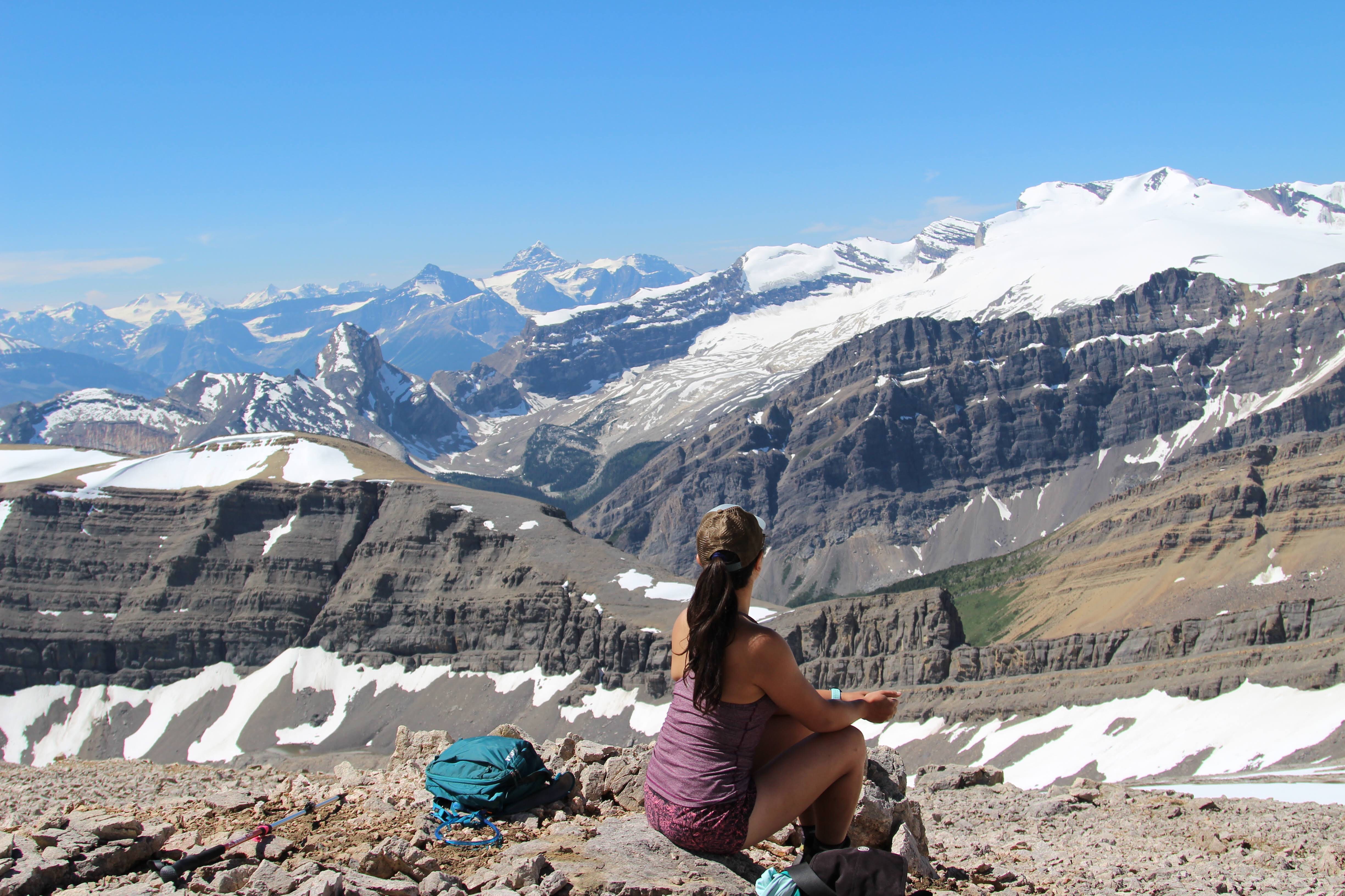
Taking a quick snack break 
We relaxed for a while, snapped some photos, had a quick snack at the summit and were soon greeted by a lovely couple who followed in our footsteps – they had also rescinded on their plans to summit Cline. Victoria and I returned back to camp by the same route, and took an extremely brisk skinny dip in lake to wash away all the sweat and grime from our mini expedition.

Victoria near the summit! 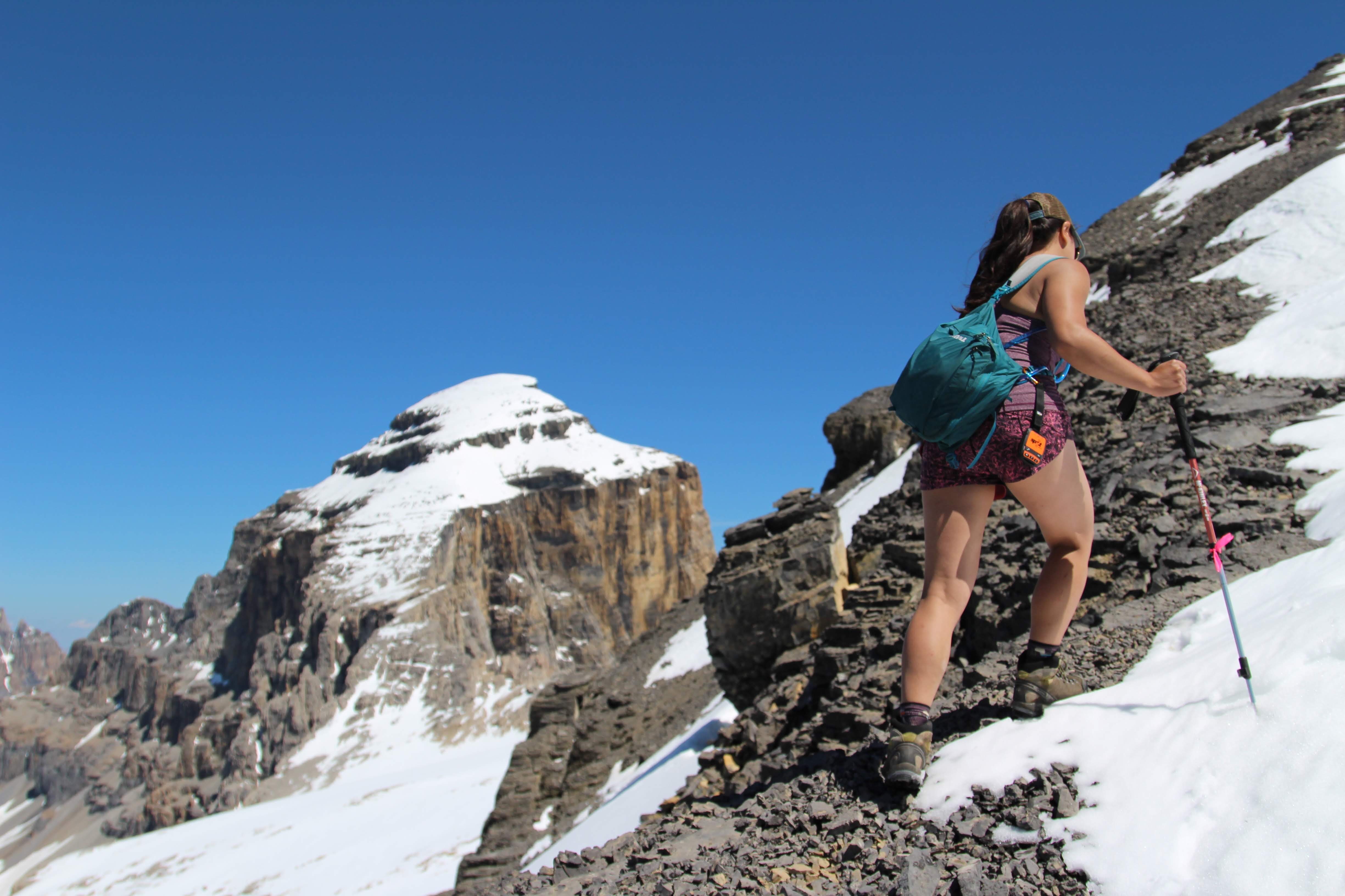
Final push to the top of Mount Owen! 
Mount Cline looking fine in the background!
The rest of the afternoon and evening we spent relaxing by the lakes, and we had a wonderful nap basking in the warm sunshine. There was also several large boulders in the area which we played around on! While we didn’t attain our original goal of summiting Cline, we still ended up having a wonderful time taking it “easy” and soaking in the beauty of camping in such an off-the-grid backcountry spot.


The next morning, we packed up camp, hiked back to the car, and drove home – capping off a successful friend-venture for 2019!
I’ll leave you with a quote that I think is fitting to cap off my series on our Friend-venture, because it’s through these wild, crazy, amazing adventures that I have grown some of the best friendships!
“May your adventures bring you closer together, even as they take you far away from home.”
Trenton Lee Stewart


2 thoughts on “Cline Lakes and Mount Owen (Friend-venture Part 3)”