On September 17th, I reunited with my friends Trish and Peishan for a fall hike. We had such a fun time doing Helena Peak together at the start of the summer, we just had to do something together again! We all took the day off work for a mid-week adventure with our sights set on bagging a peak in the Highwood Pass in hopes of seeing some of Alberta’s infamous golden larches. While we unfortunately were a bit too early for fall foliage, we did end up having an epic day out and had easily one of my top 10 (maybe even top 5?!) scrambles ever.
It’s been a couple years since I’ve done a proper scramble – so this was a special treat and it felt great to be back in my element again. The loop we took has around 500 meters in elevation of true, proper hands on scrambling and route finding. I also love a loop, because you get to see way more varied terrain, and we hit two summits in one day!
Trip Stats:
- Round Trip Time: ~6.5 hours
- Round Trip Distance: 15.3 km
- Elevation Gain: 1,407 m
- Mount Lipsett Summit Elevation: 2,560 m
- Mist Mountain Summit Elevation: 3,139 m
- Difficulty Rating:
- Easy hiking trail to Mount Lispett.
- Traverse to Mist is class 3/4 (moderate to difficult scramble depending on route chosen, lots of hands on climbing involved with loose rock and scree, mild exposure, if you fall you could be seriously injured). Helmet is recommended. Route finding skills required.
- Descent from Mist Mountain is class 1 scrambling on loose scree and then straightforward hiking on a defined trail
- Other Notes: Highway 40 at the Peter Lougheed Park to Highwood House Junction is closed annually from December 1st to June 14th. As always, be bear aware and carry bear spray when hiking in the Rockies.

Mount Lipsett
Our original plan was to scramble Mount Tyrwhitt from Highwood Pass, however we discovered that construction in the area would impede access to the trailhead so had to pivot to our backup plan to hike Mount Lipsett.
To reach the trailhead parking area from Calgary, you drive on Highway 1, then take the exit onto Highway 40 heading south. Continue straight past the Peter Lougheed Park to Highwood House Junction towards Highwood Pass. There is a small unmarked gravel parking pull out (room for ~10 cars) around 12-13 km past the Highwood Meadows Day use parking lot. Do not follow the sign for Mount Lipsett picnic area, which can be a bit misleading!
There is an obvious trail that starts behind the gravel lot, and we started our hike around 10 AM. The first half of this hike was nothing much to write home about. It meanders through the forest with the occasional peek-a-boo view through the trees of the impressive Elk Range mountains to the west. The trail was very well established, although a bit muddy in sections, and thanks to very long switchbacks, the elevation gain is quite gradual.

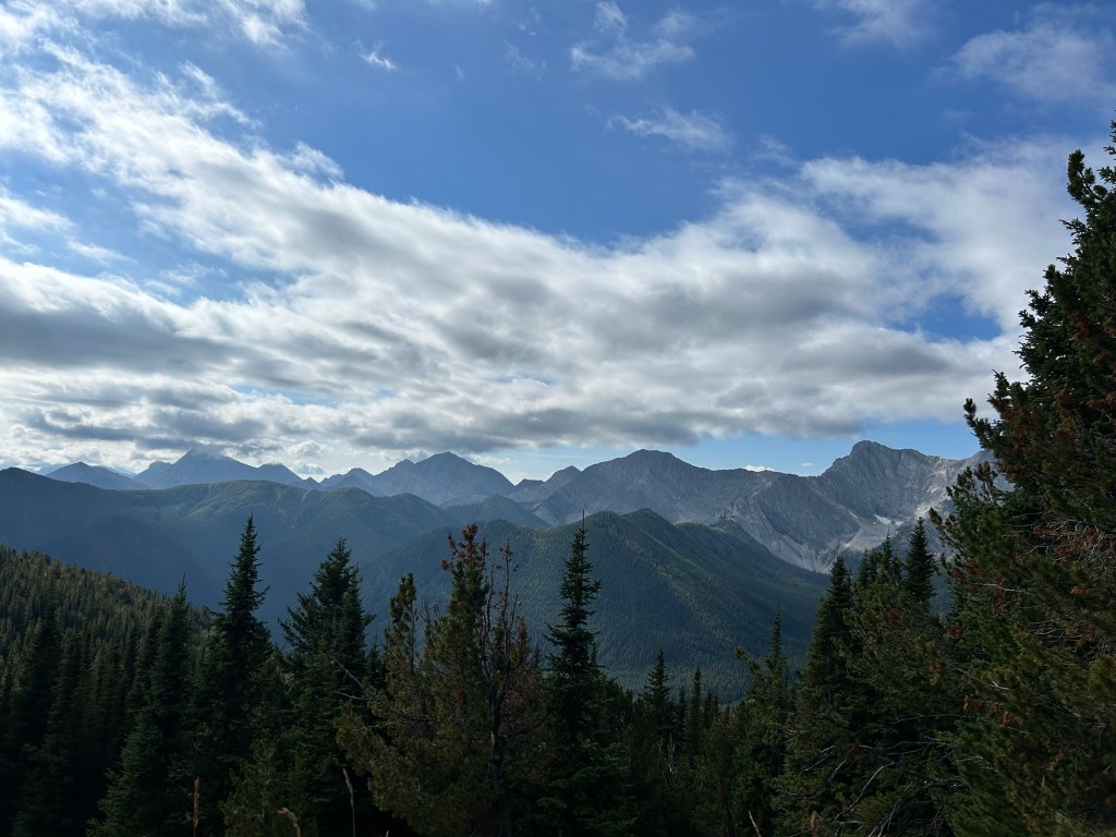

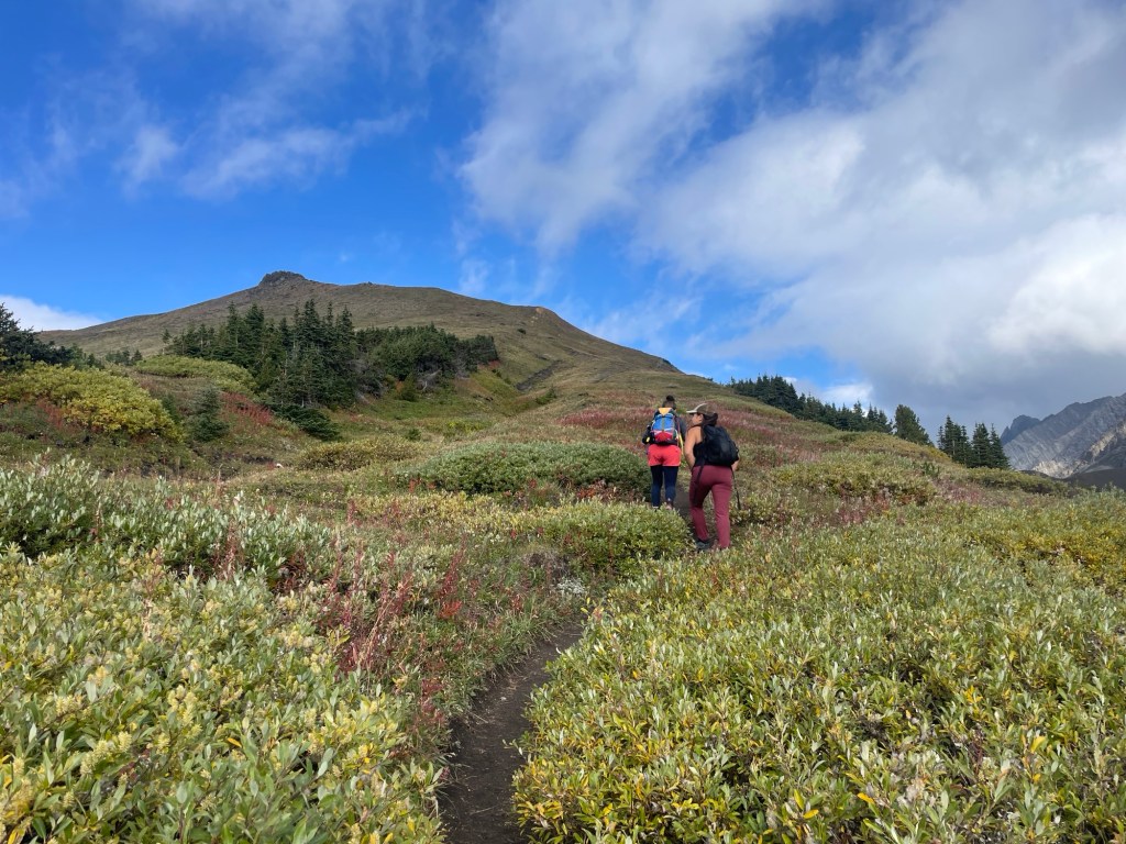
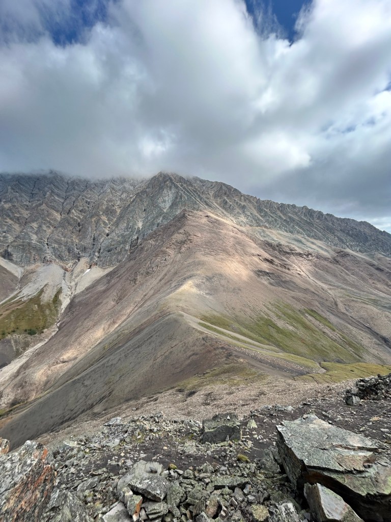
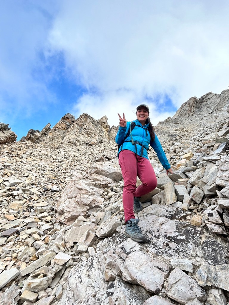
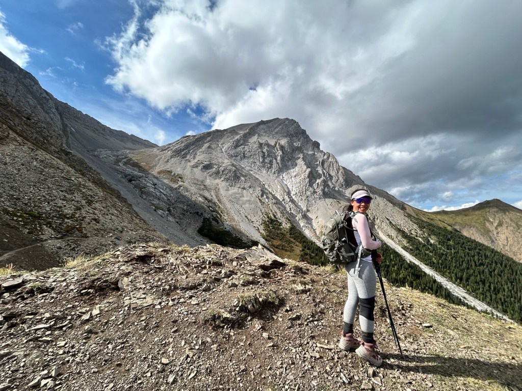
After hiking for about 5 km, we broke above the tree line and the trail opened up into a beautiful alpine meadow with panoramic views of the Elk Range. The trail continues up along the very broad and grassy ridge with a few false summit bumps to the left. Staying to the right, and avoiding these false summits, the trail steepens to gain the ridge of Mount Lipsett’s true summit. There is a very short and rocky ridge at the summit that is extremely eye catching with jagged sharp rocks and at the end of this ridge, there were impressive views of the valley to the North. It was quite windy at the summit so after taking a few photos, we found some shelter by huddling just below the ridge for quick lunch.


We realized it only took us around 2 hours to hike the 6.9 km in distance and 700m in elevation gain to this pretty little summit. But we had taken the entire day off work to adventure in the mountains – this short hike wasn’t quite enough for us! The three of us after all are quite seasoned hikers and scramblers, and are always up for a good challenge and adventure. To the east, Mist Mountain towered above us and we decided to turn our hike into a scramble, traversing the col that links Mount Lipsett to the summit of Mist Mountain, and then descend back to our cars via Mist Mountain trail on the opposite side of the mountain.
We checked our topographic maps, which indeed confirmed there is a “trail” that links the two summits, and visually mapped out a route from the summit of Lipsett across to Mist Mountain. Although the “trail” between the two summits is only 1.7 km in distance, we would have to gain nearly 600m in elevation, but we were of course up for the challenge.
Mount Lipsett to Mist Mountain Traverse
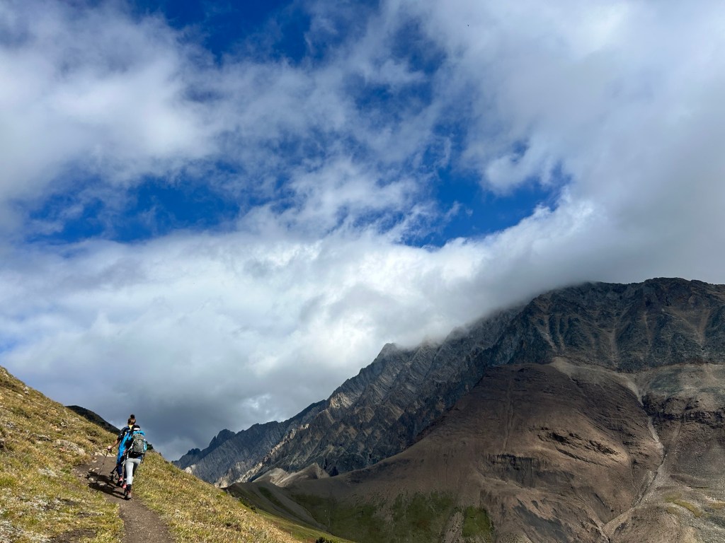
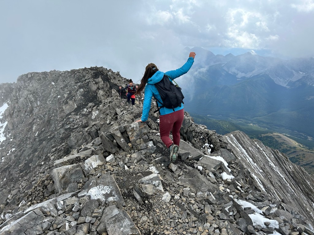
From the summit of Mount Lipsett, we backtracked around 50 m to find an simple way to descend off the ridge of Lipsett. From there it was a very short but fairly steep descent to the bottom of the col that connects the two peaks. There was then a stretch of steep scree that we slogged up. At the top of this scree pile we were faced with the somewhat intimidating west face of Mist Mountain. The face was a mess of loose rock, spiny ridges and outcropped cliffs. This is where our route finding skills had to come into play.
We had to alternate between scrambling up loose rocks nestled in narrow gullies and climbing more sturdy rocky ridges – which I greatly preferred. Although the rocky ridges were more exposed and required more hands on climbing, the rock felt more stable and we found ample hand and foot holds. There were so many different gullies interspersed with cliffs – we had to backtrack several times as not to get stuck on a cliff drop off, but slowly and surely we made our way higher.


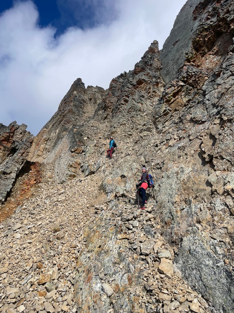
A big mistake we made – and I’ll admit it openly because I want readers to learn from our missteps, we didn’t bring helmets! Given how much loose rock on steep cliffs there are in this area – helmets would be strongly recommended. We were very fortunate that we were the only party on this route so there were no other scramblers above us who were kicking down rocks – but if there had been, we would have needed to seriously reassess our route.
To mitigate risk – the three of us maintained great communication and discussed our options constantly on this section of the climb – ensuring we wouldn’t knock rocks down on each other by staggering out, or waiting to go one at a time through more risky sections. There is no trail at all through here – we came across a single cairn – which was helpful as we had to cross over a ridge that looked potentially like a cliff on the other side, but in actuality, it led to the final ridge towards Mist Mountain summit.


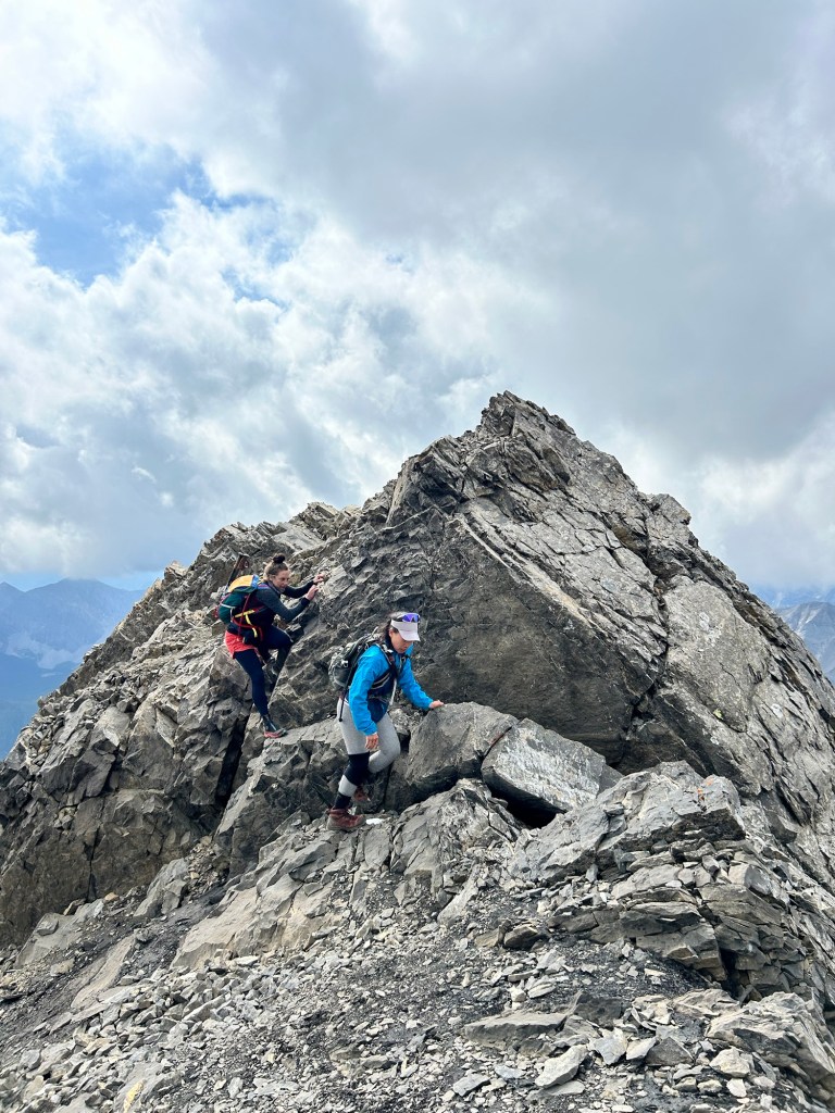


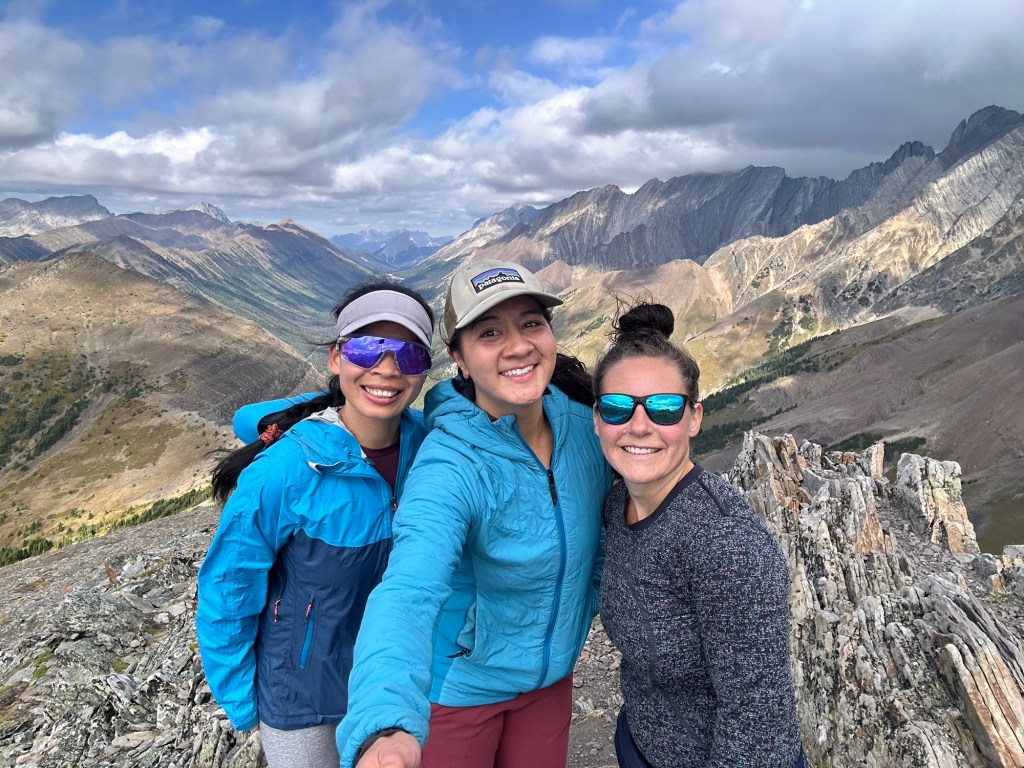
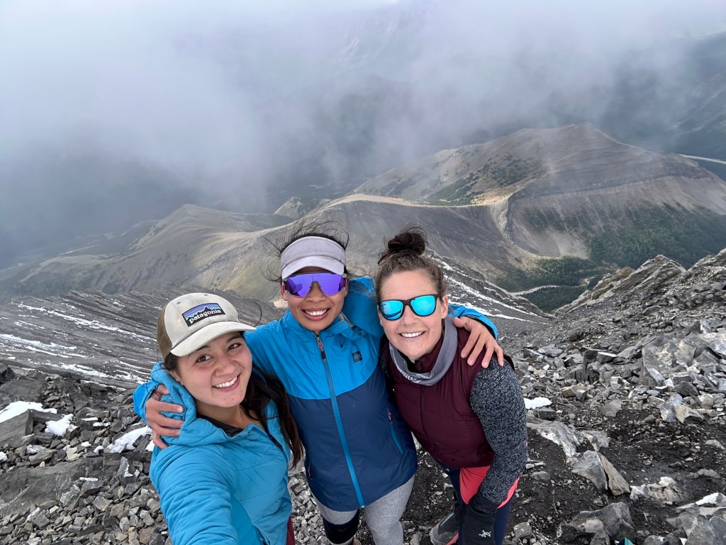
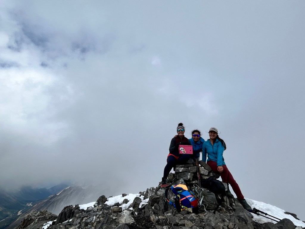
We spotted two people in the distance on top of Mist Mountain, and we knew we were fast approaching our objective! The final stretch of ridge was a bit exposed, but the ridge was quite wide and the rock was sturdy, so we felt confident traversing over to the main summit of the mountain. Trish, Peishan and I celebrated reaching the summit with a big group hug!
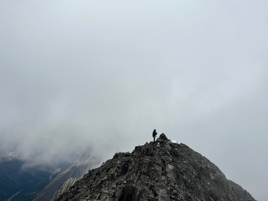
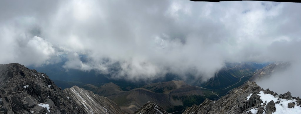
The summit was partially enshrouded in a cloud – a misty summit on Mist Mountain! It took us nearly 2 hours to complete the traverse, as route finding and taking turns up gullies proved quite time consuming. We lingered on the summit just long enough to take a few photos and watched the clouds roll through, occasionally catching a glimpse of the valley below. It was quite chilly and windy, so we didn’t hang out long before starting our descent.
Descent off Mist Mountain
We hiked back along the ridge from the main summit to the top of a broad scree gully to the south. The large scree filled bowl had a trail that pretty much went straight down and we were able to do some scree skiing to descend quickly. I was grateful that we didn’t have to hike us this scree gully as the loose rocks would have made for a tiresome hike up.
At the end of the gully, the trail wraps around to the left and opens up to a cirque. From here we continued down a much less steep trail that traverses over scree slopes that sit just below some large cliff bands. The trail eventually leads to a col that connect Mist Mountain to an unnamed ridge. Before the col, there is a trail that offshoots towards Eagle Ridge that can take hikers to the not-so-secret natural hot springs pools. It’s about a 500 m detour to head to these springs, and we considered popping by however they were quite busy. We didn’t want to have to wait for a turn as the pools are very small and can only fit maybe 2-3 people at a time. I’ll have to come back another time to try them out though!
On the south side of the col, the trail leads to a beautiful green valley with views of Odlum Ridge in the distance. It was just stunning, and looked like a scene from “The Sounds of Music!”


From here the hiking trail was obvious, and descends through the meadows back into the evergreen forests until we reached the Mist Mountain trailhead (which is again, just cars parked at the side of the highway!). The total descent from the summit back to the road was just under 5 km. From here we had to walk back north up the road to get back to where we parked our car for Lipsett, but it was only around 500m away.
We kicked off our hiking boots and the drove home – we didn’t set out expecting to do this awesome scramble, but that just made it all the more memorable and fun!

Amazing trip journaling. Looking forward for more🙌!
LikeLiked by 1 person
Thanks for being such a great adventure partner!
LikeLike