The phrase “get your pink back” has become trendy online, thanks to mommy blogger Lindsey Gurk. If you haven’t heard of it, it refers to the phenomenon where flamingos, both male and female, often lose their pink color when raising chicks. Because raising their young is so intensive, and they give so much of their food to their offspring, they often fade to gray or white. Fortunately, flamingos ‘get their pink back’ once their babies grow older and become less reliant on their parents. Gurk connects this concept to motherhood—it’s normal to change through pregnancy and early motherhood, and feel like you’ve ‘lost’ your pink. But after a while, you have the opportunity to rediscover yourself.
I mention this because this hike really made me feel like I’m finally starting to get my own pink back. Hiking and adventuring in the mountains have been such a core piece of my identity for so long. This scramble with my girlfriends was the first time in a long while that I felt reconnected with that part of myself and experienced true joy in the mountains again. So, enough about that, let’s get on with the trip report!
Helena Peak via Rockbound Lake was an excellent day trip—it truly had it all! I highly recommend this unexpectedly fun scramble to anyone willing to grind out a lot of kilometers and elevation. It checks all my boxes for a stellar day out in the mountains:
- Jaw-dropping views almost the entire way up? Check!
- Leg-burning scrambling up steep scree? Check!
- Incredible 360-degree views of the Rockies from the summit with nary a cloud in the sky? Check!
- Glissading on summer snow for a quick descent? Check!
- An extremely brisk yet refreshing skinny dip in a pristine alpine lake? Check!
Trip Stats:
- Round trip time: ~8.5 hours (including breaks)
- Round trip distance: ~24 kilometers total (8.5 km to Rockbound Lake, and then another 3.5 km to Helena Peak)
- Elevation Gain and Max Elevation: ~1,400 m; ~2,800 m
- Difficulty Rating: Class 2 (easy/moderate scramble with minor exposure and occasional use of hands for balance). A fall would result in minor injury.

Approach to Rockbound Lake
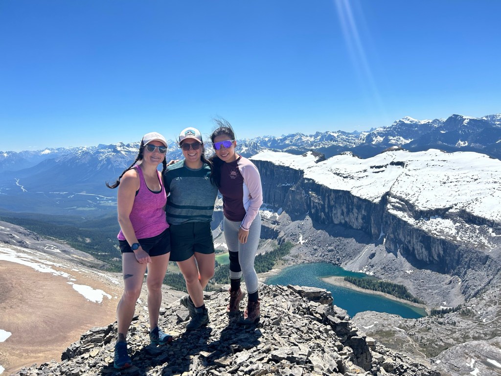
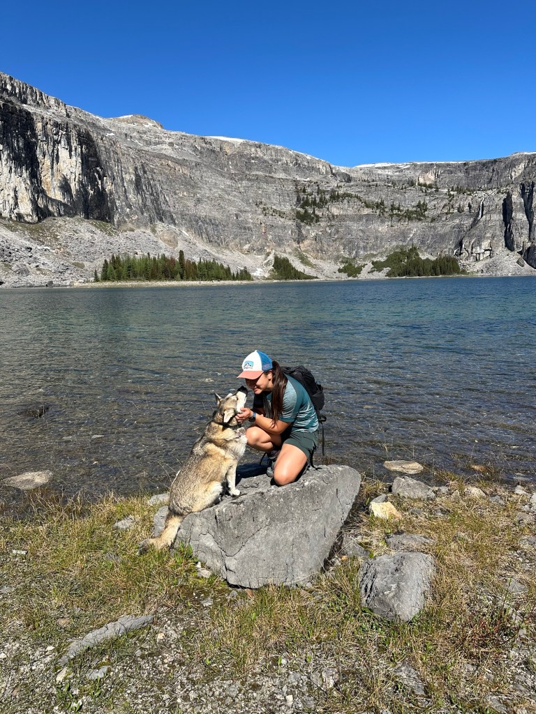
Only July 7th, 2024, my girlfriends Trish, Peishan, and my adventure pup Heidi joined me for this day hike. As always, our adventure started with a carpool from Calgary to the trailhead, and we had a great time catching up on life during the ride. I hadn’t seen Trish since our Joffre expedition pre-baby, so it was a special time to reconnect!
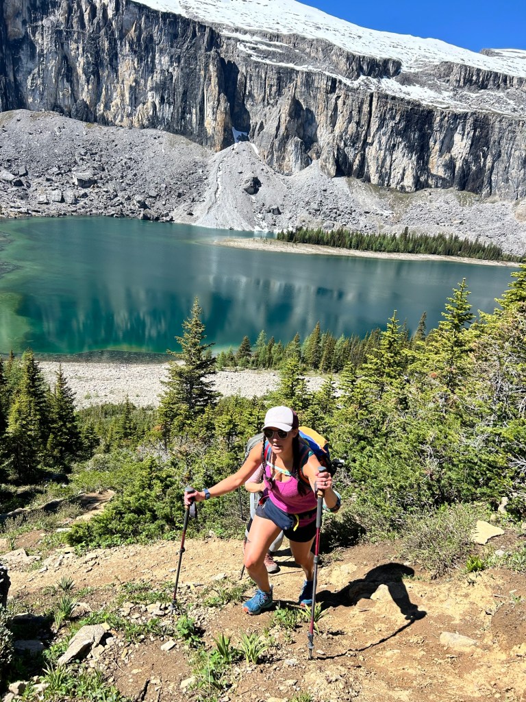
We parked at the Rockbound Lake trailhead, near Castle Mountain Junction. The lot was already bustling, so early arrival is advised for weekend hikes. The first 5 km of the trail climbs gradually through a forest, offering occasional views of the Bow Valley and the mountains to the southwest. After crossing a babbling brook, we reached beautiful alpine meadows teeming with July wildflowers.
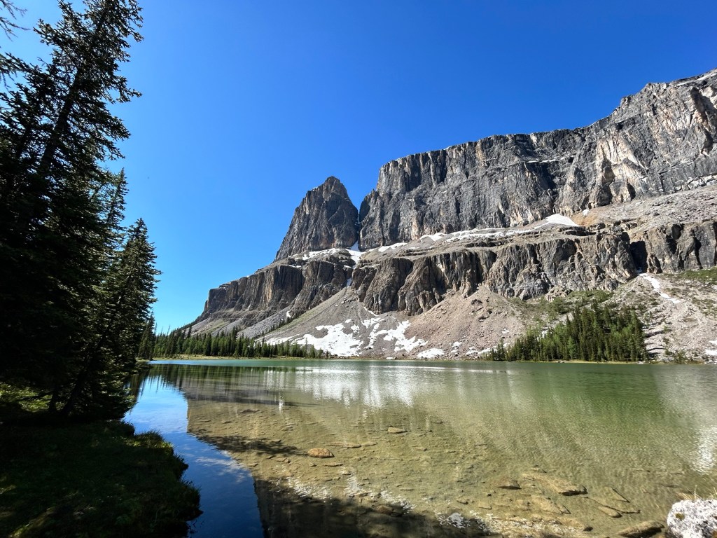
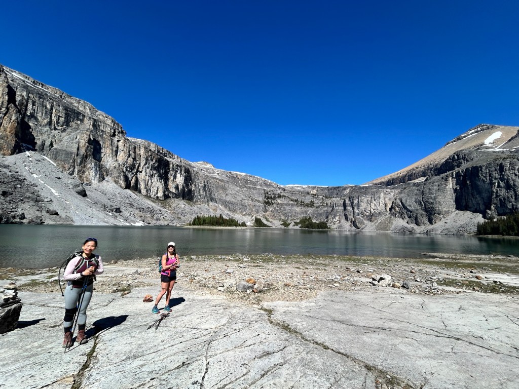
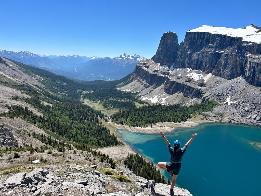
A short while later we arrived at Tower Lake where we enjoyed excellent views of Eisenhower Tower – a prominent pinnacle at the edge of Castle Mountain and an excellent alpine rock climb I was fortunate enough to do with friends a few years back. There is a sign that marks 1/2 a mile to Rockbound Lake, at which point we crossed over a wooden bridge to a steep trail that climbs above the lake. This short section led us to the shores of Rockbound Lake, aptly named for being surrounded by the massive rocky face of Castle Mountain. We took a well-deserved break here, had our first lunch, and took some pictures. Despite several other hiking groups already there, the lake’s large shoreline offered ample space for privacy.
Up to the Castle Mountain Plateau
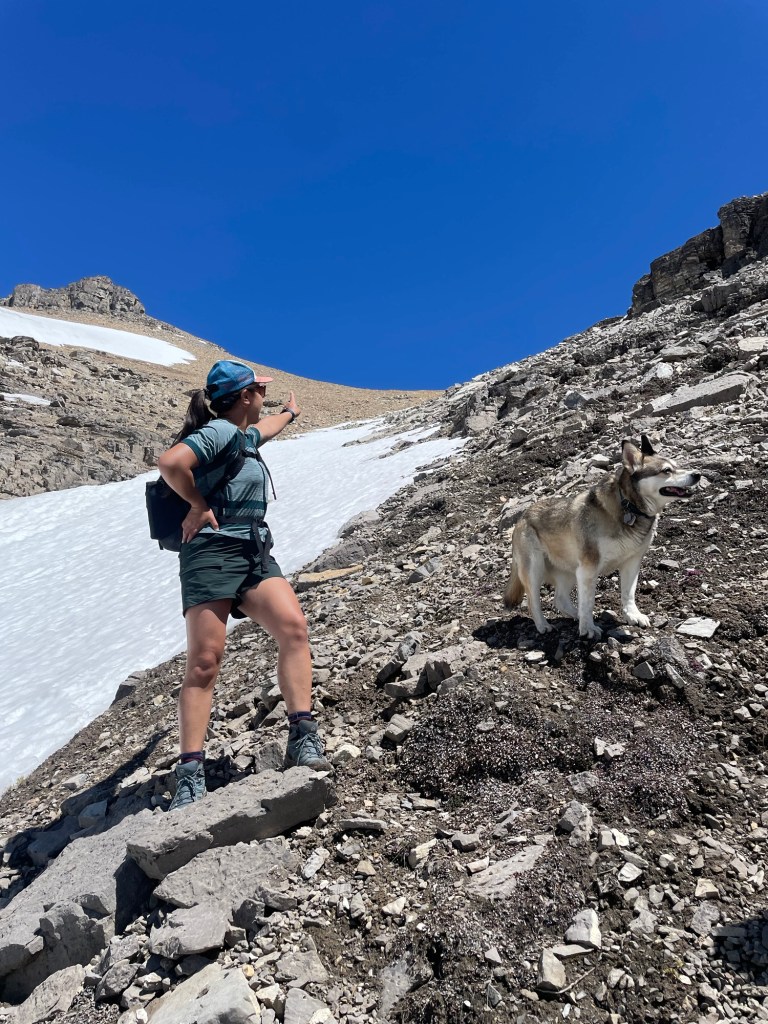
Our initial plan was to hike to the peak of Castle Mountain, but it was clear once we were at Rockbound Lake that it was still too snowbound to hike safely. The northeastern-facing slopes don’t get much sun, and despite the warm temperatures, most of the plateau was still covered in snow. However, we noticed an adjoining summit called Helena Peak that was mostly clear of snow!
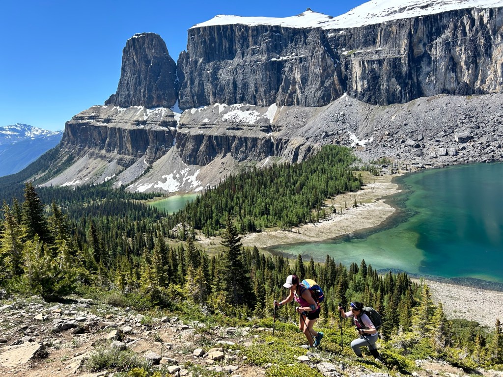
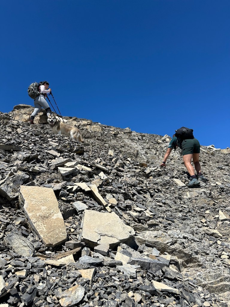
The initial approach to Helena is identical to Castle—we hiked along the north shoreline until reaching a small trail that ascends steeply up a rocky/scree section to the right of the headwall until we were just below the large cliff face that divides the upper from lower plateau of Castle. Up here, there were stunning views overlooking Rockbound and Tower Lakes—even if you don’t climb all the way to a summit, I’d highly recommend ascending this part at least a little for the aerial view of the lakes.
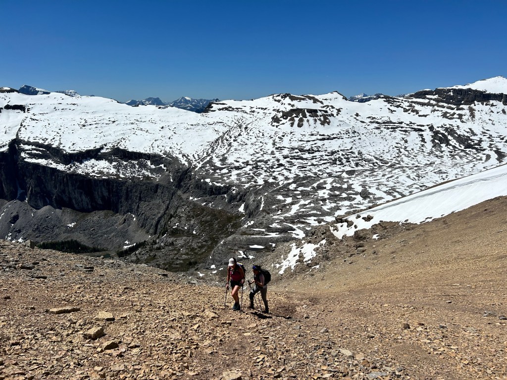
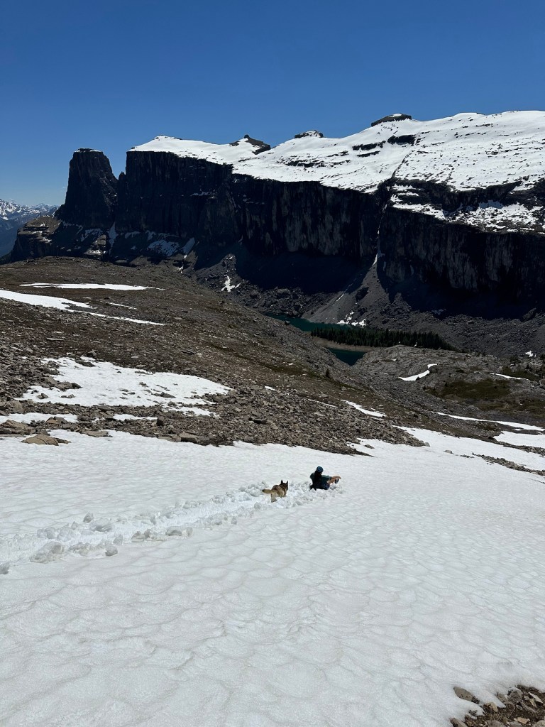
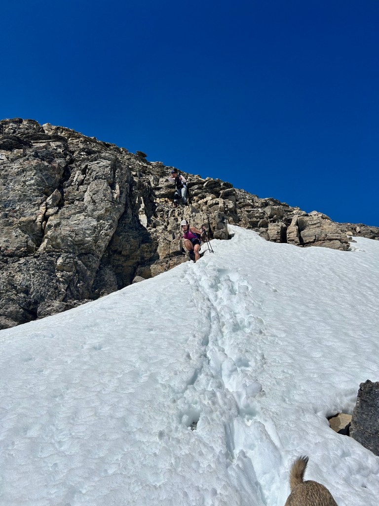
We then traversed below the cliffs, occasionally crossing near some trickling waterfalls, until we could scramble up on top of the cliff to reach the upper plateau. From here, if you want to continue to Castle, you traverse along the plateau that wraps around the backside of Rockbound Lake. However, there’s a faint trail that diverges to the right up towards Helena, which we took. The trail ascends up a gully that takes you to the saddle between Helena Peak and Helena Ridge. The middle of this gully was still filled with lingering snow, but there were enough dry spots along the side that we could scramble up the rocks and scree and mostly avoid getting our feet wet.

Final Push to the Summit
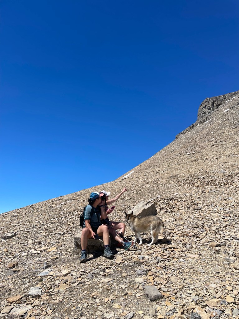
At the top of the gully at the saddle, we took a breather and admired the stunning views now available to us to the east. From here, we turned left and ascended the final 150m elevation gain to the summit of Helena Peak. The ascent was very rocky, with some sections of scree, and near the top, one small scramble over larger rocks. I was really impressed with my old girl Heidi for crushing it up as she’s not the young dog she once was on large mountain expeditions!
The views from the summit were breathtaking. I’d argue they were even better than the views we would have had from Castle Mountain (compared to the views we had from the top of Eisenhower Tower). We had unobstructed 360-degree views of the mountains in every direction. It was so clear that I could spot several prominent mountains in the area, including Mount Hector to the north, Assiniboine and Mount Bell to the west, and the Valley of the Ten Peaks to the northwest.
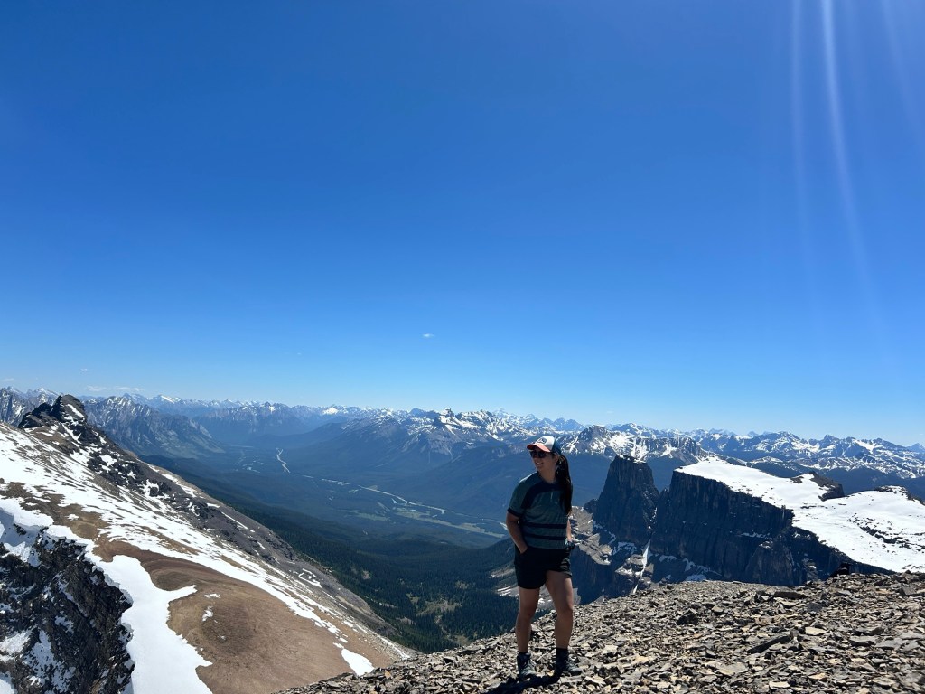

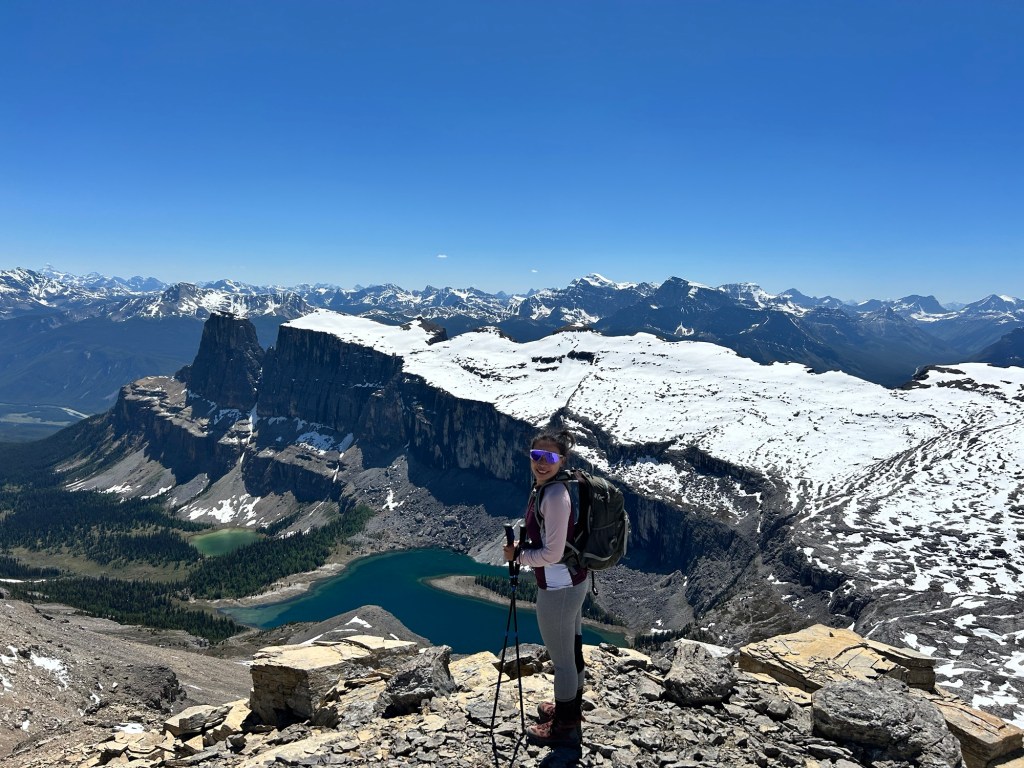

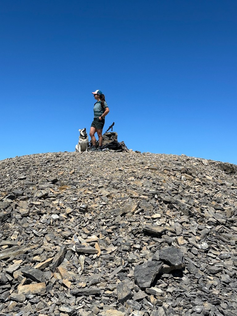
Trish, Peishan, and I took about a zillion photos because it was just stunning in every direction. We had a fantastic view of the entire Castle Mountain Plateau and Rockbound Lake, glittering with diamonds and showing off its rich teal coloring. Heidi took a much-needed nap at the summit cairn, and we all ate our second lunch!
Descent Back Home
The descent route is identical to the ascent for this scramble. Once we got back to the gully that we initially ascended to reach the saddle, there was enough snow that we could glissade most of the way back to where the trail levels out on the plateau. This was ridiculously fun—in case you don’t know, glissading is “the act of descending a steep snow- or scree-covered slope via a controlled slide on one’s feet or buttocks.” I wrapped my raincoat around my waist to make a butt covering and we took turns sliding down to the bottom of the gully in mere minutes – safely, save for a bit of “ice burn” on the exposed parts of my legs from the grainy snow.
Once back at the lakeshore, it was very quiet on the east side. I love a good alpine lake dip and make it a mandatory part of my summer adventures (weather permitting). Today was perfect for a summer skinny dip, with the sun out and temperatures in the mid-to-high 20s (Celsius). The three of us stripped down to our birthday suits and plunged into the icy lake. It was much colder than I expected, and on my first dip, I probably lasted only 2 seconds before running back to shore! But it didn’t take long to warm up again in the sun, and soon enough, we had a second and third plunge to refresh ourselves.
Feeling fresh from our “swim,” we started the long descent back to the trailhead. This, for me, was actually the toughest part of the hike. The best views were behind us, and there was nothing more to do than hike 8 km through the woods back to our car on tired and achy feet. While my friends and I happily chatted most of the day, our conversations were more stilted for this final stretch, and even Heidi seemed to be dragging her paws a bit.
When we finally reached the car, we joyously stripped off our hiking boots and socks and traded them for sandals. We drank a ton of water and shared high fives all around! What an incredibly successful and rewarding day in the mountains!

The phrase “get your pink back” is so powerful and I am glad to be part of the journey of yours.
The April blog mentioned a lot about how the social media would define the coolness yet you’ve always been very cool in my eyes. It is hard not to doubt about ourselves sometimes but I believe that your journey will keep thriving.
Looking forward to more:).
LikeLiked by 1 person
Thanks for reading & encouragement, and more importantly thanks for joining on the adventure!
LikeLike